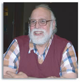
Dr. AlanVonderohe
Professor Emeritus · Geodesy, Surveying & Geospatial Information Science
October 7, 1947 — November 5, 2025
Everything moves
all the time.
A Visit With Him
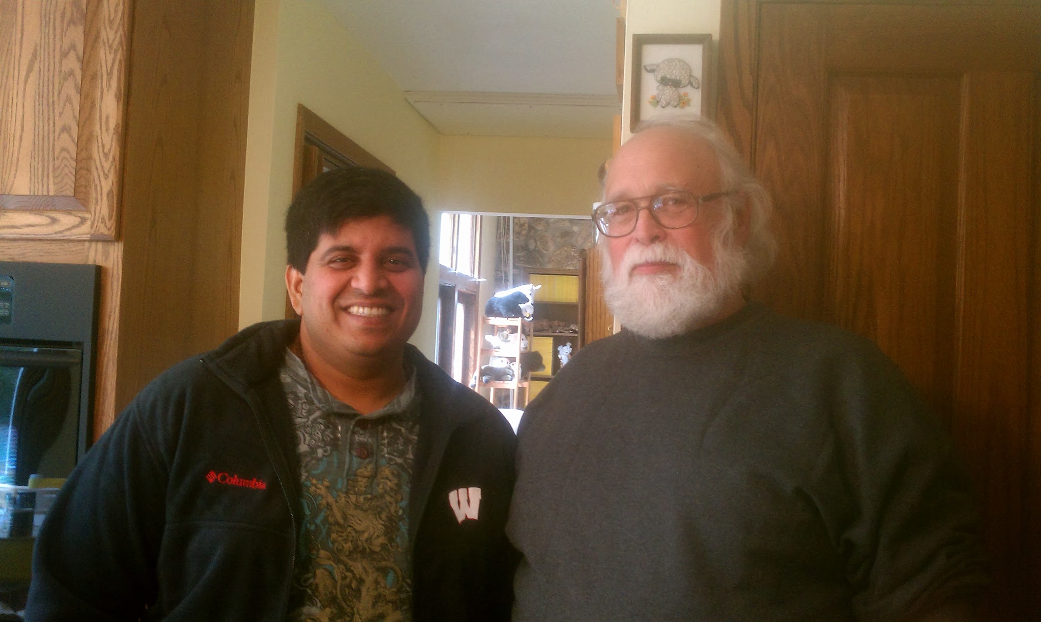
With Professor Vonderohe, at his home in Wisconsin.
A Remembrance
The teacher who helped us see beyond GIS
Most will remember Professor Vonderohe for surveying, geodesy, and land information systems. I remember him as something else. A guide. Long before digital twins or geospatial operating systems were fashionable, he was teaching us to think beyond maps and beyond software.
Many were taught coordinates. He taught reference frames.
Many were taught mapping. He taught that we are an interconnected mathematical system.
The Man in the Corner
The one question that silenced the room
Student presentations. The weekly seminar. A big lecture from a visiting scholar. Any talk at all — Professor Vonderohe was usually the quiet figure in the corner, listening more than he spoke.
And then he would ask the one question after which the whole room fell silent — at the sheer depth and magnitude of his thinking.
When he did speak, you understood why the room had been waiting.
A Moment at a Closing Door
“I don't care if Arcinfo can't do it.”
I caught him in the east wing of Engineering Hall as he closed his office door — anxious. I needed a raster dataset for my project, and the leading GIS software of the day had no tool to edit rasters. I told him I was stuck. Without breaking stride, he said:
“I don't care if Arcinfo can't do it… do you understand what you need to do?”
And he left. In one sentence he had separated the science from the software. The tool's limits were not the problem's limits.
How He Defined the Field
“When a single person must coherently conduct many different disciplines of science — without breaking the laws of any one of them — a new discipline of science is born.”
Such is geospatial information science.
The Class With the Secret Name
Read “engineering” as a verb, not a noun
His course was Engineering Applications of GIS — yet none of the case studies were, strictly, engineering problems. So I asked him why he'd named it that. He answered with a question.
Prof V“Did you learn anything from the class?”
Me“I learned how to develop solutions rooted in geospatial models.”
Prof V“That's it. That's the meaning of the class. Read ‘engineering’ as a verb, not a noun.”
“Very few got the meaning of the class — including faculty who debated putting it on the curriculum. Glad you got the point.”
Things He Said
“You will be a PhD when you know what you don't know.”
“There is nothing called teaching. You can only help the willing learn.”
“You understand dimensions when you can see why a point is dimensionless.”
“We are orders of magnitude smaller than ants biting a big apple — and we are not the apple.”
His Voice
Geodesy as a conversation
Most geodesists write like engineers. Professor Vonderohe wrote like a teacher — framing the whole subject as a dialogue between a patient Guru and an impatient student who only wanted to make a map.
Chapter One · Underlying Reference Frames
Guru“Everything moves all the time.”
Me“That rock over there isn't moving. It's sitting still.”
Guru“Take two steps toward the rock… Now, did the rock move?”
Me“Alright, alright! I'm just trying to make a map here on Earth.”
Guru“Have patience. At some point, I'll try to help you make connections.”
Everything Moves All the Time
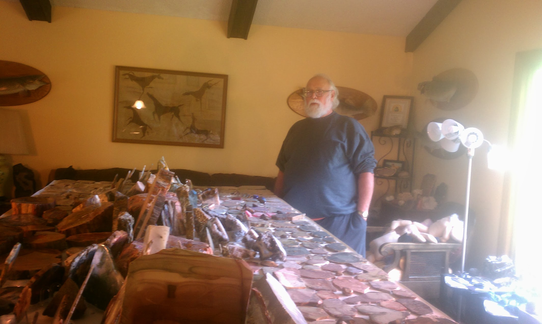
The geodesist who taught that everything moves all the time — at home among the stones that, for a little while, sit still.
A Last Lesson
Even time bends to where you stand
In the final chapter of his last book, he explained that two identical clocks, under different gravity, keep different time — then turned all of that physics into something human and unforgettable:
“I can infer that my head is slightly older than my feet — because it's been above them most of the ‘time.’”
For Professor Vonderohe, GIS was never just technology. It was the wonder hiding inside the ordinary task of making a map.
A Life in the Science of Place
Alan Paul Vonderohe
In His Own Words
The New 2022 Datums: A Brief Book
The New 2022 Datums — A Brief Book
Dr. Alan Vonderohe · Professor Emeritus, UW–Madison · 2019
Four short, conversational chapters — reference frames, the NATRF2022, gravity, and the geoid — written, in his words, for “anyone who wants to understand more about the new datums.” A small masterclass in making the profound approachable.
Read the book (PDF) →With Deepest Gratitude
Thank you, Professor Vonderohe.
We say this out loud, and with humility. How much we were given, most of us understood only long after we left his classroom — and we carry the debt gladly.
A true American scientist.
A real geospatial guru.
Carry It Forward
Were you taught by Professor Vonderohe?
The best memorial to a teacher is not a plaque.
It is the work that continues because they taught us how to think.
If Professor Vonderohe shaped your work or your thinking, your memory belongs here. We are gathering recollections from the students and colleagues whose lives he touched.
Share a memory →Curated by Kiran Manchikanti · Founder & CEO, Mapsol Geo · former student